Your Comprehensive Guide to Mt. Fuji’s Geography

As Japan's tallest peak, Mt. Fuji stands at 3,776 meters (12,388 feet), its perfectly symmetrical cone dominating the skies. A UNESCO World Heritage Site, this active stratovolcano is a revered symbol of the Land of the Rising Sun and a complex geological wonder. Understanding Mount Fuji's geography, from its volcanic formation to its surrounding landscape, is not just about appreciating its physical grandeur, but also about gaining a deeper understanding of its cultural and historical significance.

Eager to learn about Mt. Fuji’s tectonic origins, volcanic history, surrounding ecosystems? You’re in the right place. Read on!

Mt. Fuji geographical stats

A woman in front of Mt. Fuji
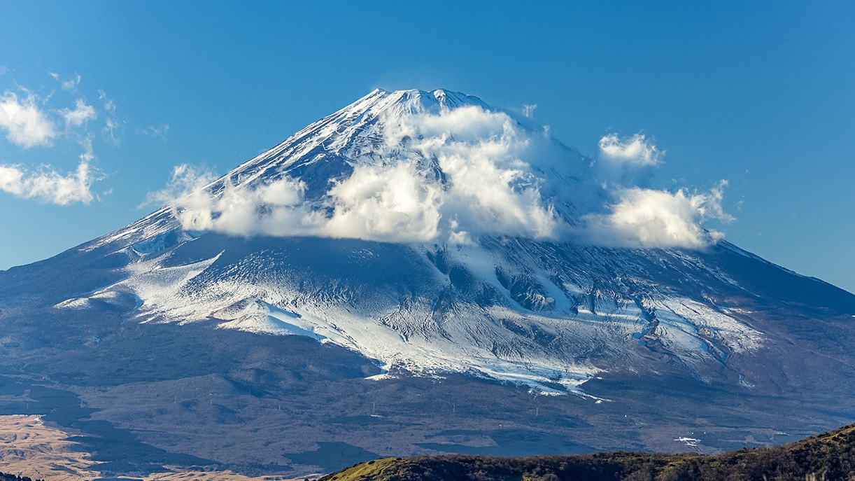
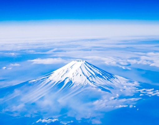
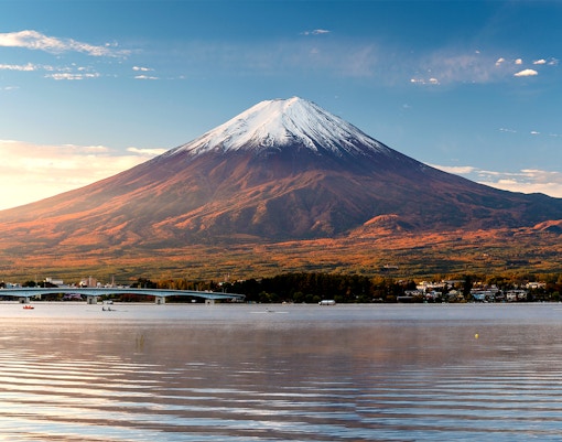
  • Elevation: 3,776.24 meters (12,389 feet) 
  • Location: Honshu Island, Japan. Straddles the border of Yamanashi and Shizuoka prefectures.
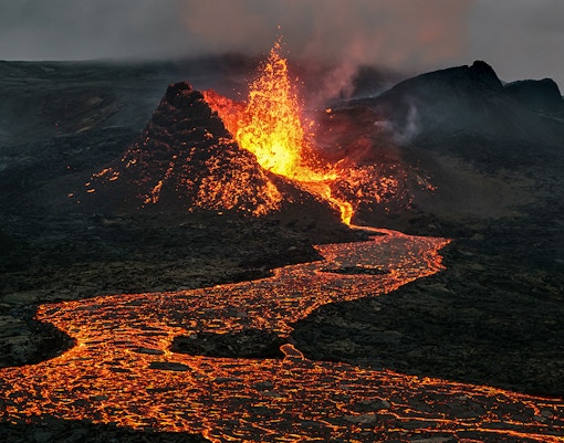
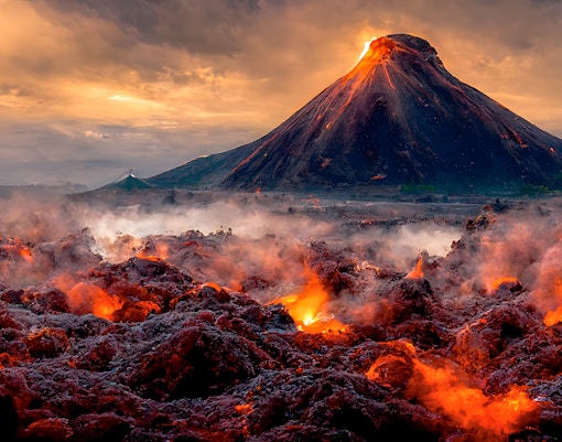
  • Last eruption: 1707 (classified as active but dormant)
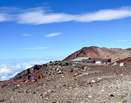
  • First ascent: Recorded ascent by monk En no Odzunu in 663 AD
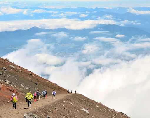
  • Hike difficulty: Moderate to challenging
  • Type of volcano: Stratovolcano (composite volcano)
  • Number of trails: 4 main trails: Yoshida Trail, Subashiri Trail, Fujinomiya Trail, and Gotemba Trail. 
  • Crater diameter: Approximately 780 meters (2,560 feet)
  • Base diameter: Approximately 40-50 kilometers (25-30 miles)
  • Number of crater peaks: Eight peaks surrounding the central crater
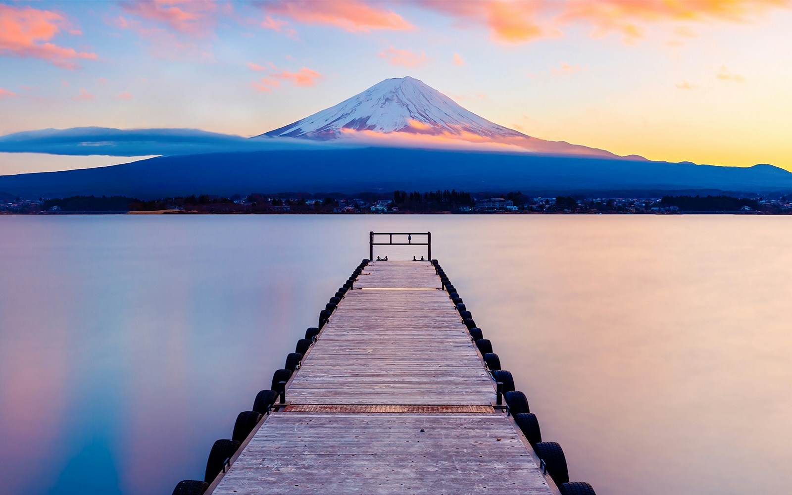
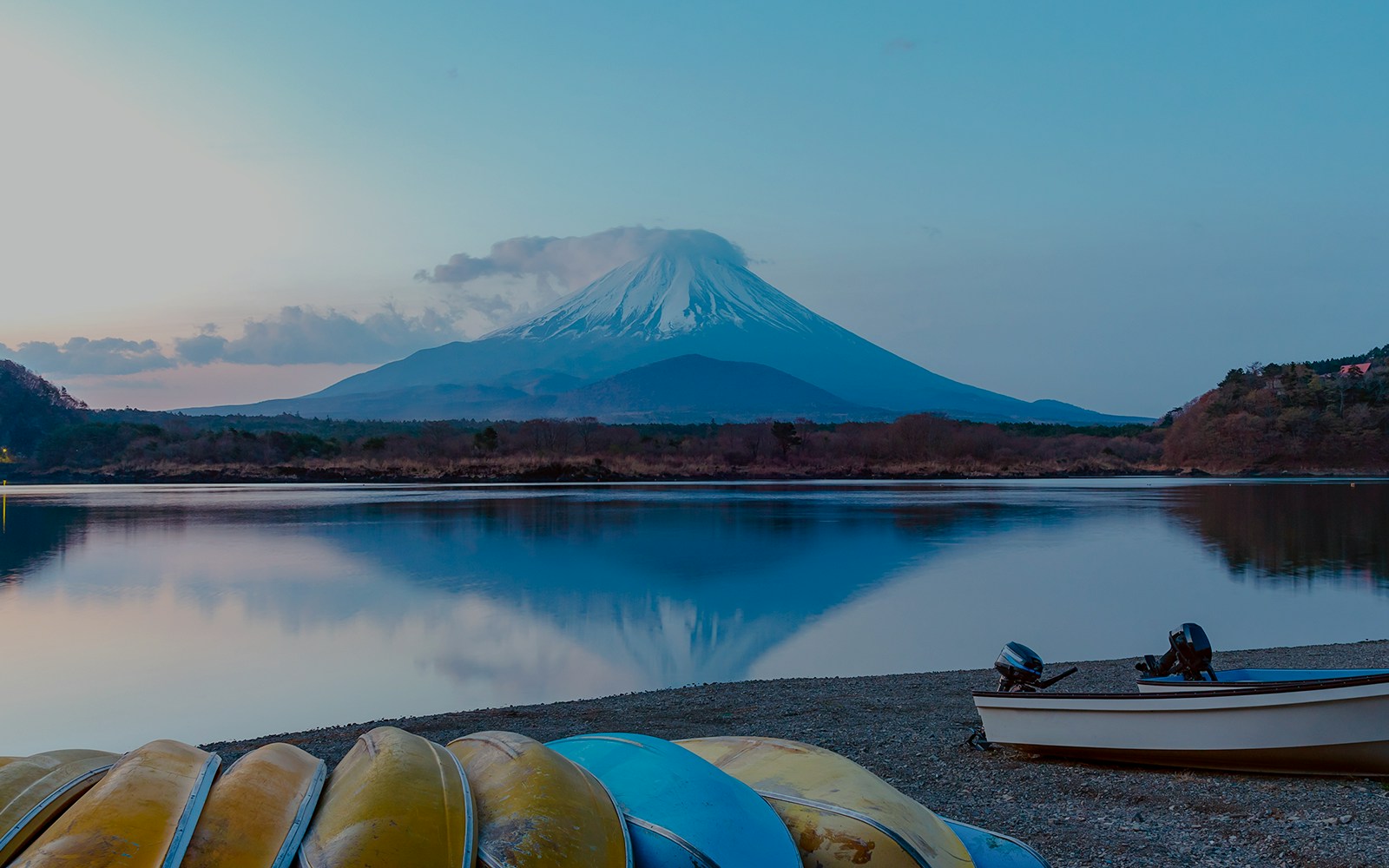
  • Nearby geographical wonders: Fuji Five Lakes: Lake Kawaguchiko, Lake Yamanakako, Lake Saiko, Lake Shojiko, Lake Motosuko, Fuji-Hakone-Izu National Park, Tanzawa-Oyama Quasi-National Park, Hakone Caldera.

Where Does Mt. Fuji stand? Location and formation

Reflection of Mt. Fuji in Lake Kawaguchi

Island: Honshu

Distance from Tokyo: 100km

Find on map

Mt. Fuji, also known as Fujisan, is situated on the main island of Japan, Honshu. It straddles the border of two prefectures: Shizuoka to the south and Yamanashi to the north. It stands approximately 100 kilometers (62 miles) southwest of Tokyo, making it visible from the Japanese capital on clear days.

A closeup of Mt. Fuji's peak
  • Mt. Fuji is a classic example of a stratovolcano, also known as a composite volcano. These are formed through the gradual accumulation of lava, ash, and volcanic debris ejected during numerous eruptions over a long period.
  • The specific formation of Mount Fuji is attributed to the complex interplay of subduction zones, where one tectonic plate slides beneath another. 
  • The Philippine Sea Plate subducted beneath the Okhotsk Plate and the Amurian Plate, creating a zone of intense heat and pressure that triggered the melting of rock in the mantle, leading to the formation of magma. This magma eventually rose to the surface, erupting and solidifying to form the layers of Mt. Fuji.
  • While the exact timing of Mount Fuji's formation is still under investigation, geological evidence suggests it began forming around 400,000 years ago.
  •  The present-day mountain is a composite of 3 successive volcanoes: Komitake, Ko-Fuji (Old Fuji), and Shin-Fuji (New Fuji)
  • Over millennia, eruptions from Ko-Fuji and subsequent weathering processes gradually reshaped the landscape, ultimately leading to the formation of the iconic cone we see today.

The 4 phases of Mt. Fuji

Mt. Fuji is the result of a millennia-long complex geological history. Did you know geologists identified four distinct phases of volcanic activity that contributed to its formation, each with its own fascinating story? Here’s a simple breakdown of each phase.

Sen-komitake

  • Period Approximately 400,000 - 100,000 years ago.
  • Characteristics: Composed of andesite, a type of volcanic rock with a light-colored, fine-grained texture.

The first chapter of Mount Fuji's story began with Sen-komitake, a fiery andesite volcano that laid the foundation deep within the earth. Its eruptions ceased, leaving behind a hidden testament to the mountain's fiery beginnings.

Komitake-Fuji

  • Period Approximately 300,000 - 100,000 years ago
  • Characteristics: Composed of basalt, a dark-colored, fine-grained igneous rock formed from cooled lava flows.

Time marched on, and another chapter unfolded with Komitake-Fuji. This phase saw eruptions of basalt, a darker and denser lava, adding another layer to the growing mountain, shaping its base, and setting the stage for the next chapter.

Ko-Fuji (Old Fuji)

  • Period Approximately 100,000 to 17,000 years ago.
  • Characteristics: Composed of alternating layers of lava and ash, forming the bulk of the present-day mountain's structure.

History took a dramatic turn with Ko-Fuji, a stratovolcano. Unlike its predecessors, it built its form through alternating layers of lava and ash, gradually taking shape over Komitake-Fuji. This phase, lasting for approximately 83,000 years, formed the bulk of the present-day mountain's structure.

Shin-Fuji (New Fuji)

  • Period 10,000 years ago to the present.
  • Characteristics: Composed of lava and ash, shaping the familiar, nearly symmetrical cone that defines Mount Fuji's visual identity.

This ongoing phase has seen continued eruptions, shaping the mountain's iconic symmetrical cone. The most recent confirmed eruption occurred in December 1707, leaving behind a new crater and ash deposits. And, while still classified as an active volcano, it is currently dormant.

Exploring Japan’s tallest mountain: Mt. Fuji's height & prominence

Height

Imagine 9 Empire State Buildings stacked on top of each other. That’s how high Mt. Fuji is. The peak stands tall at a staggering 3,776.24 meters (12,389 feet). But how does Mount Fuji compare to global titans? Mount Fuji stands above the challenging Ben Nevis (1,345 meters) in Scotland, the highest point in the British Isles and even lords over the tallest mountain in Spain and the highest point of land in the Atlantic Ocean, Mount Teide (3,718 meters)

Prominence 

In mountaineering terms, Topographic Prominence is a peak's vertical rise above its surrounding landscape. It measures how isolated a mountain is from higher neighbors.

Mount Fuji's prominence:

  • With a prominence of 3,776 meters (12,388 feet), exactly its own height, Mount Fuji stands completely independent of any surrounding mountains.
  • This exceptional value signifies its towering dominance over the surrounding landscape, making it a truly isolated and majestic peak.

Landscapes around Mt. Fuji

Lady taking a picture of Mt Fuji from Oishi park, Kawaguchiko lake, Around Tokyo 1 day tour

Fuji Five Lakes

Nestled around the base of Mount Fuji, the Fuji Five Lakes ((Kawaguchiko, Yamanakako, Saiko, Motosuko, Shojiko) are a collection of scenic freshwater lakes renowned for being the aquatic mirrors of Mount Fuji and diverse recreational activities like boating, fishing, and hiking.

Mt. Fuji with a leading dock in Lake Kawaguchi, Japan
Swan in lake Yamanaka with Mt.Fuji in the background
Sunrise at Lake Saiko with Mt. Fuji in the background
Mount Fuji at twilight after sunset, view from Lake Shoji

Mt. Fuji trails & routes

It’s not just the destination with Fujisan, but also the journey. The four ancient natural trails, worn by pilgrims for centuries during their ascents offer an unforgettable journey before you reach Mt. Fuji’s summit.

Fujinomiya Trail

  • Difficulty level: Moderate 
  • Hours to reach summit: 6 to 8 hours

Known for its gentle slopes and shorter ascent, ideal if you’re a first-timer or someone seeking a less strenuous climb. Get up close to Mount Fuji's southern slopes, with convenient access from Fujinomiya Station, and shorter climbing time compared to other trails.

Yoshida Trail

  • Difficulty level: Moderate 
  • Hours to reach summit: 5 to 7 hours

The most popular and well-developed trail is known to be the traditional pilgrimage route. Get access to historical sites like Yoshida Sengen Shrine and stunning views of perched mountain huts.

Subashiri Trail

  • Difficulty level: Moderate to challenging
  • Hours to reach summit: 6 to 8 hours
  • A less crowded option cutting through dense forests and volcanic terrain. Enjoy sights of neighboring valleys and unique rock formations like the Twin Boulders on your way up.

Gotemba Trail

  • Difficulty level: Very challenging
  • Hours to reach summit: 7 to 10  hours

The shortest but steepest route offers a direct and challenging ascent. This is perfect if you're an experienced and well-prepared climber. Catch a beautiful sunrise, black lava fields, and more on this trail.

Frequently asked questions about Mt. Fuji’s geography

Yes, Mount Fuji is classified as an active volcano, although it is currently considered dormant. The last confirmed eruption occurred in December 1707.